
Credit: Serge Salat, Urban Morphology Institute, based on material produced by Gehl architects.
Master plan framework with ecology at its heart in huechuraba, santiago, Chile
This reading will display a project by Gehl in Chile to show how master planning can produce neighbourhoods which are integrated, and place sustainable development at the heart of the planning process. The team delivered a Masterplan Framework, including a Public Space Strategic Framework, and Typology’s Studies to guide a new urban district with a networked public realm. The Masterplan Framework unites the city, existing neighbourhoods, and rural and mountainous landscapes with a particular understanding and utilization of the sites’ unique ecology.
Introduction

Site context transcending urban, rural and mountainous landscapes. Source: Gehl Architects.
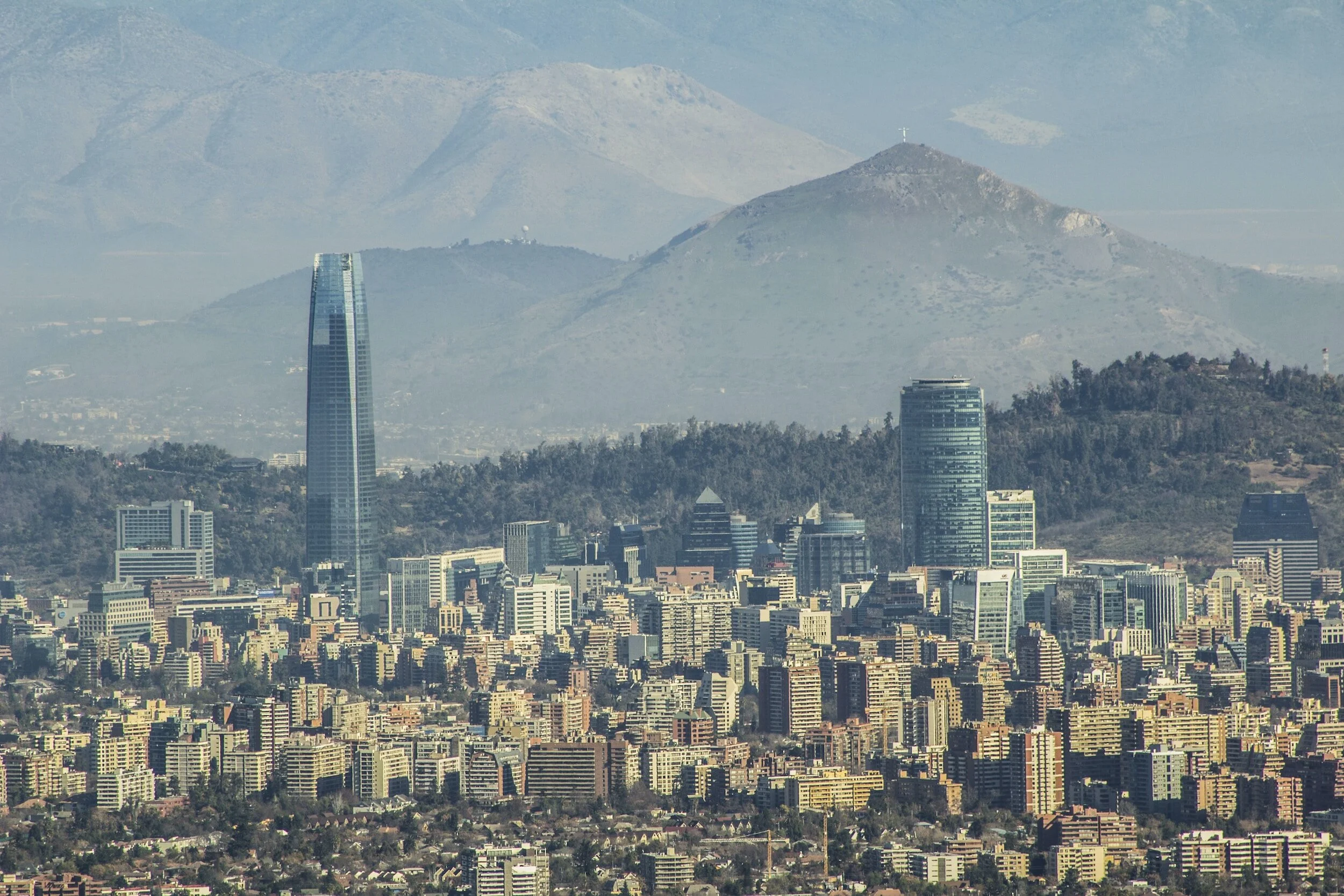
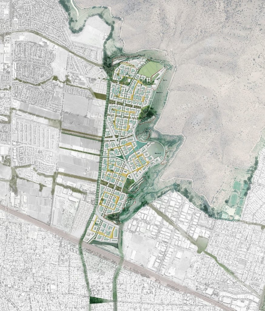
Santiago is the capital of Chile and one of the largest and most cosmopolitan cities in South America. With a metropolitan population of almost 7 million, the city lies in the country’s central valley, leaning directly against the Andes to its east, and the Chilean Coastal Mountain range to its west. This wonderful and unique setting hosts a city that has developed rapidly in recent decades from a historic central urban core, out across previously agricultural land and onto the foothills of its surrounding mountain ranges.

The original site is a mix of greenfield and agricultural land surrounded by the foothills of the Andes. Source: Gehl Architects.
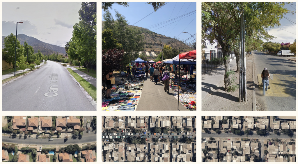
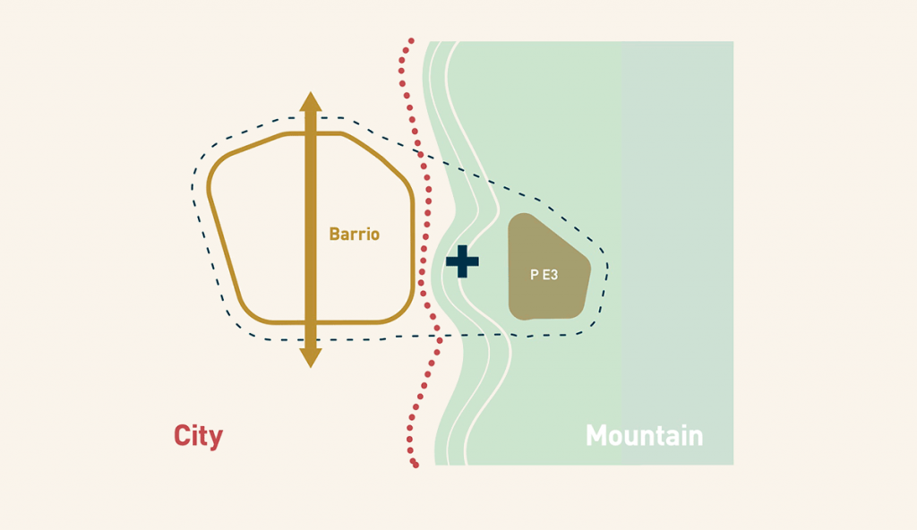
Today, the city’s periphery still retains a mix of agricultural and urban land use, often abruptly demarcated with walls and fences. At the northern point of the city lies the district of Huechuraba. There, Gehl was invited by landowner and developer Tanica to create a Masterplan Framework.
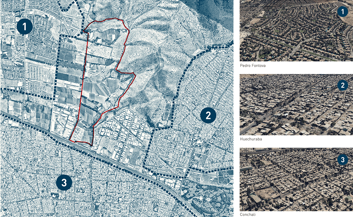
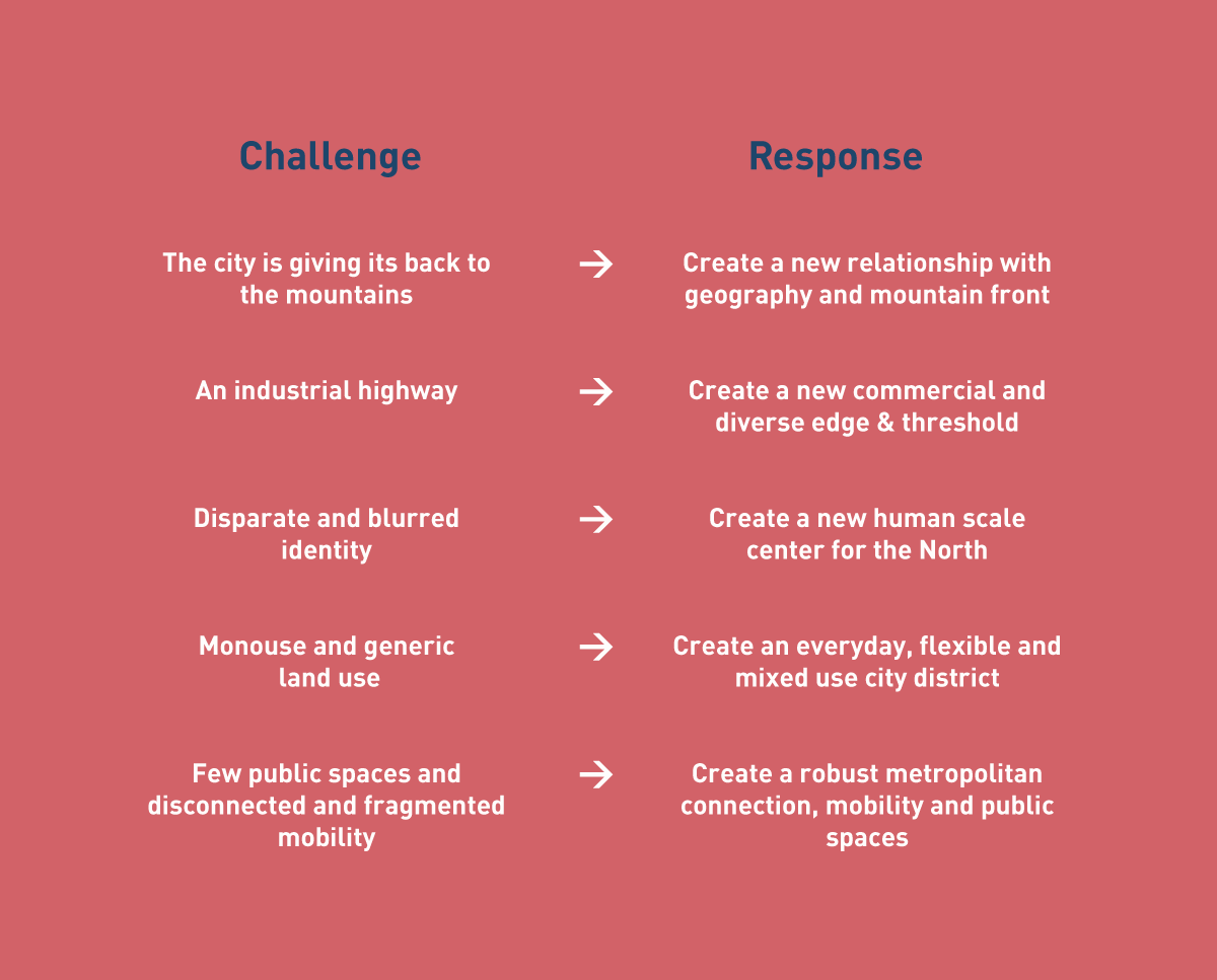
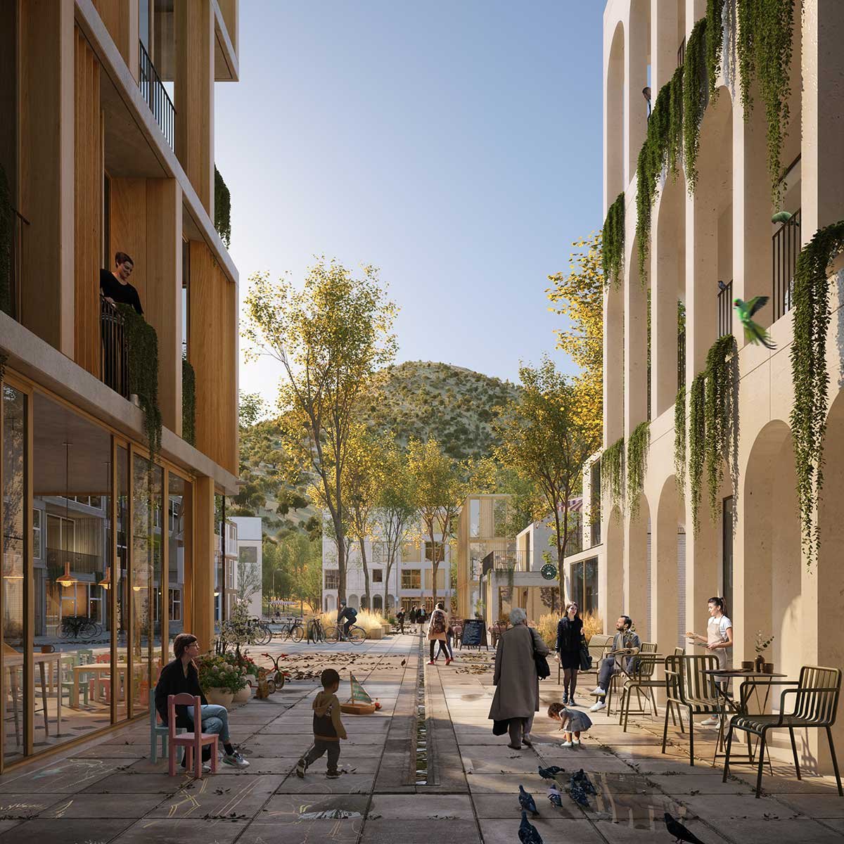
With very distinct natural conditions, urban typologies and infrastructure framing the site; the Andes mountains directly to the north, a highway to the south and existing neighbourhoods to the east, south and west, the client wanted to create something different, breaking from the traditional urban development approach and subsequent results. Huechuraba should become the most beautiful, vibrant, inclusive place for people – an open invitation as the gateway to the north of the city and further into the captivating nature of the surrounding mountains.
Health Check – taking stock of the site

The current interface between residential and agricultural land. Source: Gehl Architects.
Initiating the project Gehl conducted what we call a ‘Health Check’. The purpose of such a study is to collect data specific to public space and public life. This includes mapping physical infrastructure and what quality it is in, and the basic movement flows and activities of people – which supplements existing data and knowledge of the site and its surrounding areas. This creates an objective and contemporary understanding of how the area is performing, a baseline upon which the Masterplan Framework can be developed.
The Health Check revealed two very different neighbourhoods bordering the site. On one side, a neighbourhood of residential gated communities with little public life and invitations for people to spend time in public space, and on the other, a denser mixed-use neighbourhood with vibrant public life qualities. The juxtaposition of the site’s surrounding neighbourhoods presented a clear opportunity for our site to create a more equitable people place, that would not only serve its own future residents but invite neighbouring communities in – to unify through public space invitations.
The Application of Health Check on the project. Source: Gehl Architects.
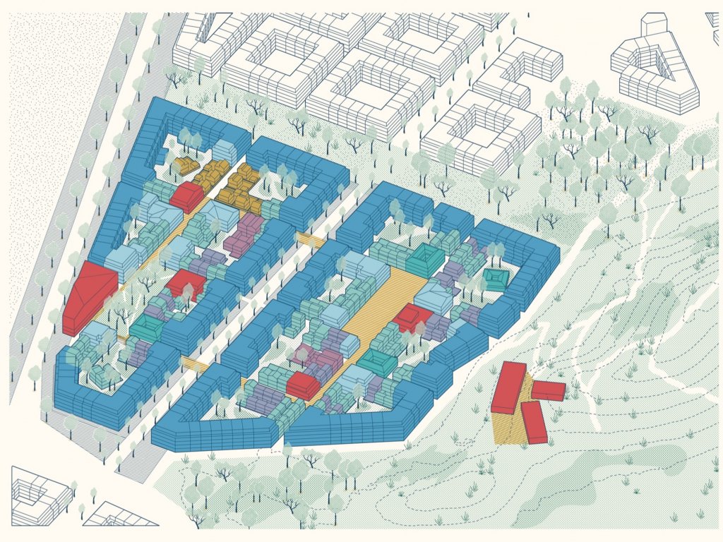
masterplan framework
With this knowledge at hand, the Masterplan Framework was structured in two parts. The first, a Public Space Strategic Framework that analyses existing physical conditions of the site to inform potential public spaces and street hierarchies. The second, Typologies Studies, that identify and define what type of building typologies can best deliver the desired public life, meet existing and future market demands for housing, and ultimately help improve the diversity and quality of public spaces and their identified qualities.
Public space strategic framework
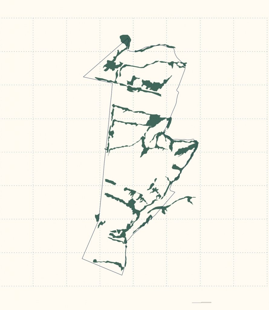
The Public Space Strategic Framework establishes specific physical characteristics of the site and determines a public space plan that sets a clear hierarchy of streets and public spaces that will inform future urban layout and design. They mapped:
Connecting Roads, trails and paths.
Ancient Trees.
Agricultural Plots.
Water and Fluid analysis to determine danger or water retention areas.
Topographic analysis to identify unique spatial conditions.
Sight-lines and points of opportunities.
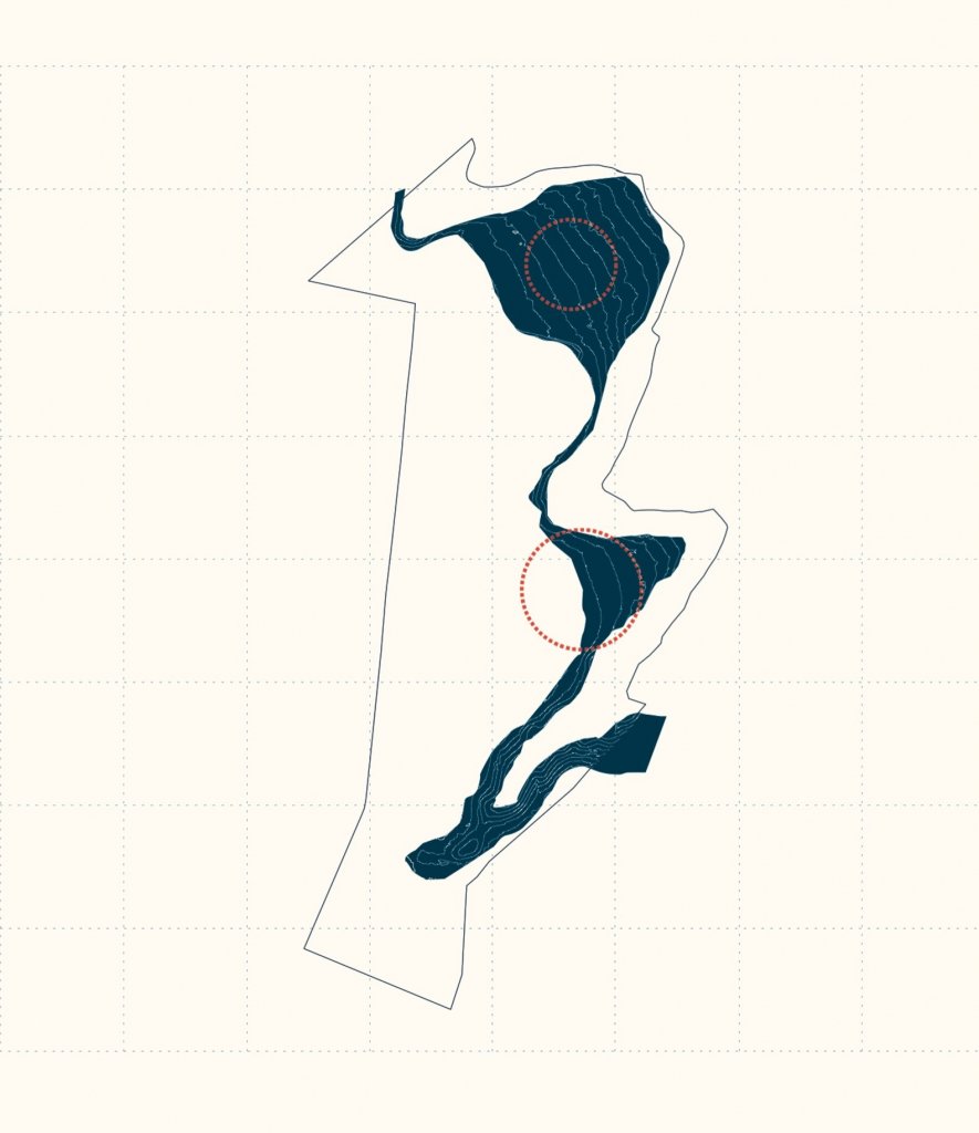
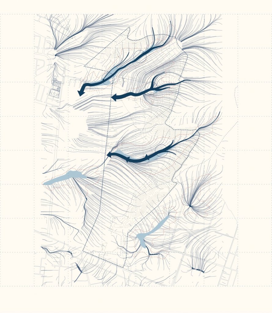
Left: Existing tree cover. Middle: Slope contours. Right: Water flow and retention. Source: Gehl Architects.
Public space plan
Given the site’s context and physical potentials and limitations, it is important to establish a clear street network and public space hierarchy. Gehl defines hierarchy by large, medium and small scales. We know that planning for space hierarchy is the essential foundation for people to be able to understand and relate to a space’s identity and functionality. From large scale unifying boulevards to small scale alleys and local streets, the hierarchy informs people’s perception of spaces, both consciously and subconsciously, which in turns informs intended behaviours. This is particularly important in places with high densities, allowing for spaces to use the best of their physical characteristics to perform a certain function and/or induce certain behaviours and feelings.
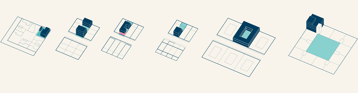
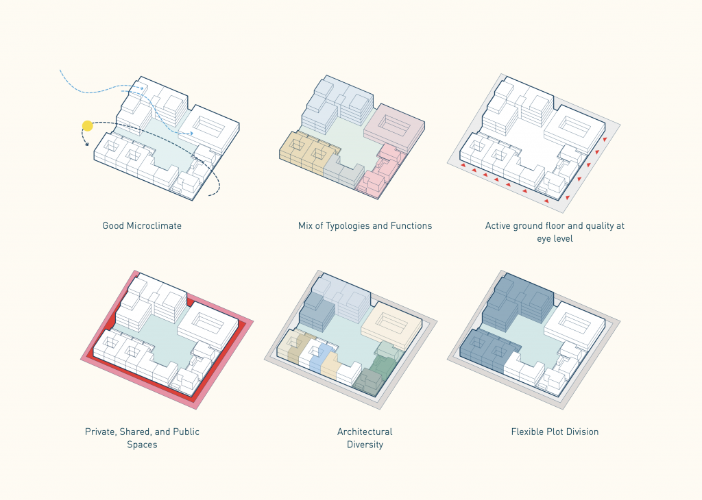
Typologies studies
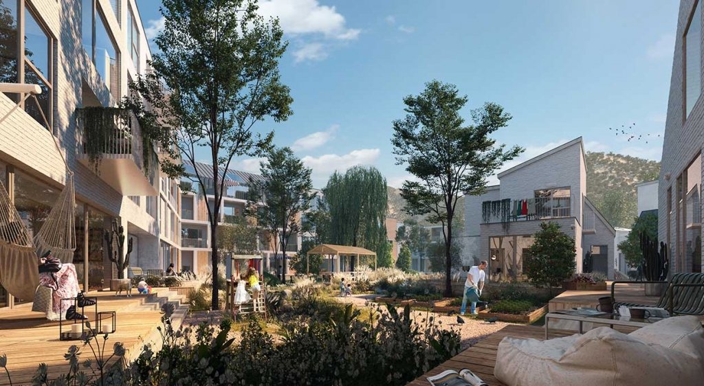
Building on the proposed urban layout and space hierarchy set forth in the public space plan, we embarked on typological research, identifying and defining what type of building typology could support the creation of a diverse, inclusive and equitable public life. Working at the block scale, Gehl developed a ‘kit of parts’ that provides applicable building typologies according to the variation of expected users in any given area. By including a mix of typologies; the courtyard house, the apartment building, the townhouse, the row-house, the work live house, and the single-family house, the block becomes a framework for embracing diversity – providing varied degrees of public space according to its place characteristics and intended functionality. Organising blocks, and the network of blocks (neighbourhoods) also allows for the management of the unique variables that come with such a geographical location – that being warm sunshine and cold, dry shade. The diversity of typologies provides options to adjust and refine the experience of outdoor micro-climates which in turn informs the use and feel of public space – a self-fulfilling loop centered on making the best of Huechuraba’s natural conditions for people’s everyday lives.
Masterplan framework
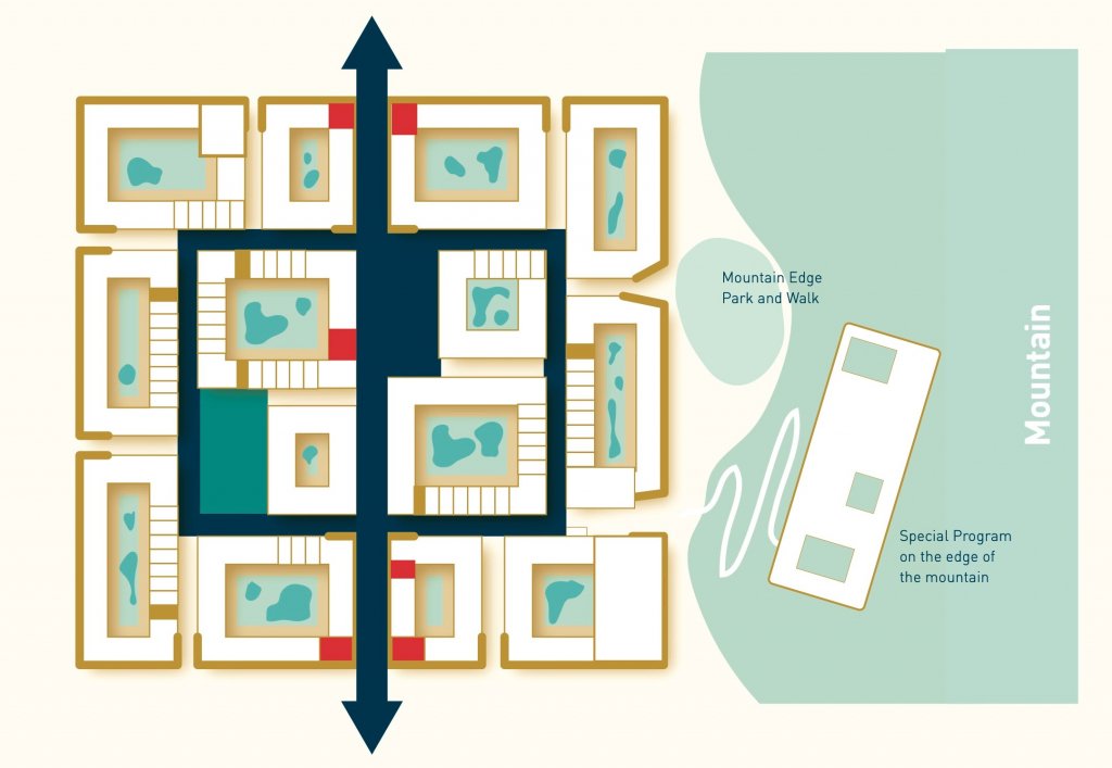
It is proposed that each Barrio has a special program that integrates the mountain edge with it, providing unique purpose and identity points. These include food, technology, recreation, culture, education and health programming. Also, each Barrio has an internal system connecting public space and built form. This comprises an edge, a crossing main street, an internal loop, a hard plaza, a park, and a special programme.
Way forward
Gehl delivered the Masterplan Framework in September of 2019. Alongside Gehl, the client has now selected a couple of architectural offices to start the building design for the first neighbourhood. We will work closely with these stakeholders to help guide and direct the design processes to achieve a human scale, and softer Huechuraba. Construction started in October 2021.