
Credit: Serge Salat, Urban Morphology Institute, based on material produced by Gehl architects.
Evaluating public life in Wuhan’s historic district, china
This project in Wuhan’s historic Hankou District is a collaboration between Gehl, China Sustainable Transportation Center (CSTC) and the Wuhan Planning and Design Institute (WPDI). The team worked on understanding how the district’s streets and public spaces handle the daily pressures put upon them, and provided recommendations toward a more coherent and liveable public realm that supports people’s everyday practices, local culture and commerce. To identify and prioritize future urban planning actions, the team recommended the development of a coherent Public Space Plan, and 12 ‘key moves’ in transport, public life, the built environment and climate resilience. This case study provides a concrete example of how a people-centre planning approach can be implemented. It displays tools for data collection and how these are then reflected in key strategic planning actions.
Introduction

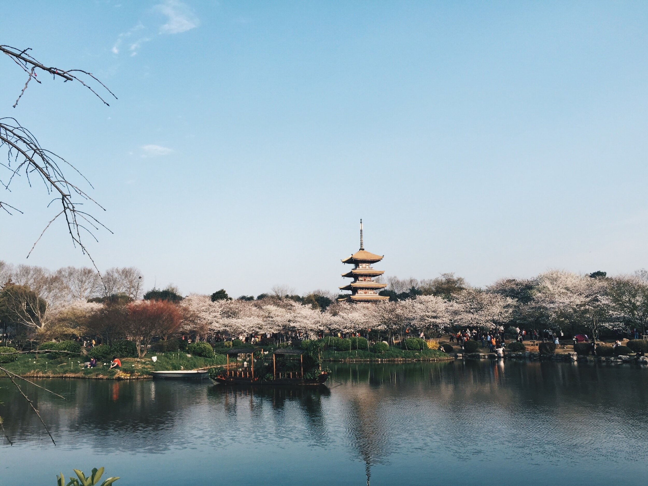
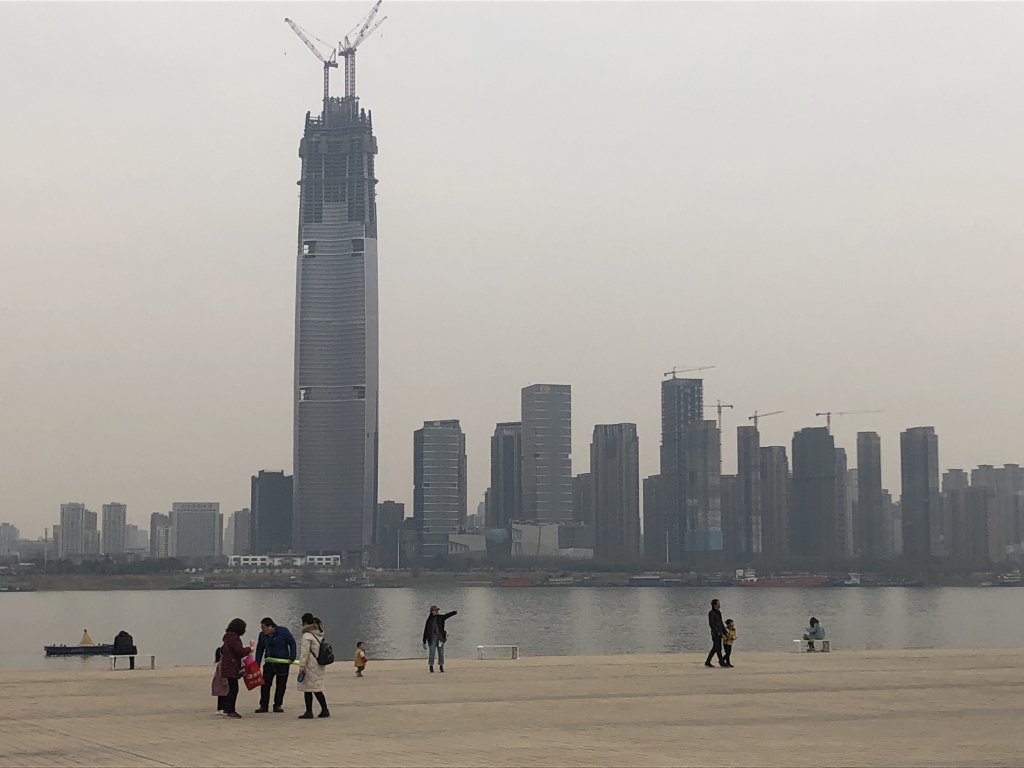
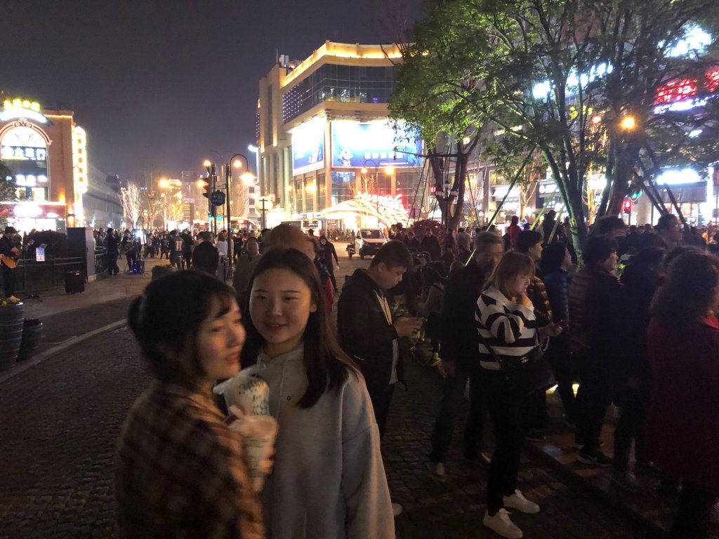
The Hankou District is the historic and cultural center of Wuhan. It sits along the iconic Yangtze River and you can find an incredible range of urban contrasts within its territory. Small pedestrian street networks weave between 6 lane highways, hyper commercial shopping zones buffer cozy residential areas, and the numerous food streets promote an exciting transition from day to night.
Source: Gehl Architects.
Before the word 'Covid-19' existed as part of our daily vocabulary, Gehl travelled to Wuhan's historic Hankou district to conduct a Public Space Public Life Survey and advise on how the district can improve its public realm for and with its people.
Gehl was invited to Wuhan’s historic Hankou District by close collaborators China Sustainable Transportation Center (CSTC) and the Wuhan Planning and Design Institute (WPDI). There, we were tasked with understanding how the district’s streets and public spaces handle the daily pressures put upon them, and provide recommendations toward a more coherent and livable public realm that supports people’s everyday practices, local culture and commerce.
As the Hankou District continues to grow with more residents, businesses, and visitors each year, it is faced with many challenges that threaten its historic character and attractiveness as a place for people. However, in recognising and addressing these challenges now, there also exists many opportunities to build upon the strong foundation of public life that exists in the district in line with the city’s ambitions to grow in a more sustainable way. To identify and prioritise future urban planning actions, the Wuhan PSPL recommends the development of a coherent Public Space Plan, and ‘key moves’ across the urban typologies of transport, public life, the built environment and climate resilience. Guidelines and an easy to use evaluation framework are presented, enabling Wuhan to plan holistically, leveraging the districts existing strengths, and minimise future planning contradictions within its own borders and with neighbouring urban areas.
Public Space Public Life Survey
Gehl used a three-prong approach to collecting data in Hankou, owing to the scale of the survey area and the expected high numbers of people across the district. Gehl’s PSPL, conducted by over 30 local students, collected observational data including movement counts of pedestrians, bicycles, e-bikes and motorized traffic (cars, buses, lorries), activity mapping, age and gender registrations, dB measurements, and test walks. This was supplemented by the PinStreet Hankou App which invited people over two days to provide their opinions on walking and staying environments, and thirdly, a big data analysis was carried out by CityDNA, helping qualify the empirically collected data.
One of the most outstanding data points that we uncovered was the true scale of Hankou’s pedestrian flows. The district’s streets hold some of the highest numbers of pedestrians compared to many of our prior PSPL counts globally. We found that one of the main shopping streets in Hankou had almost three times more pedestrians than People’s Square in Chongqing, with pedestrian numbers comparable to Sydney, Moscow, and Shanghai.
Haunou District – The Challenges
1. Wuhan is one of China’s 15 most polluted cities. Despite the presence of large parks and the Yangtze River, and multi-modal transit accessibility the District suffers from severe air pollution. Some days the pollution is so thick you can hardly see building tops across the street.
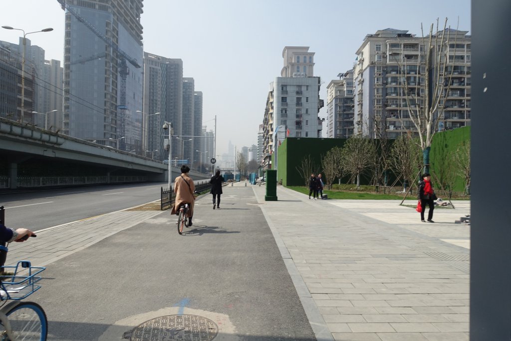
2. Newer developments are generally not built to the human scale, opting for wide inaccessible fenced setbacks and tall footprints that alienate and dwarf residents.
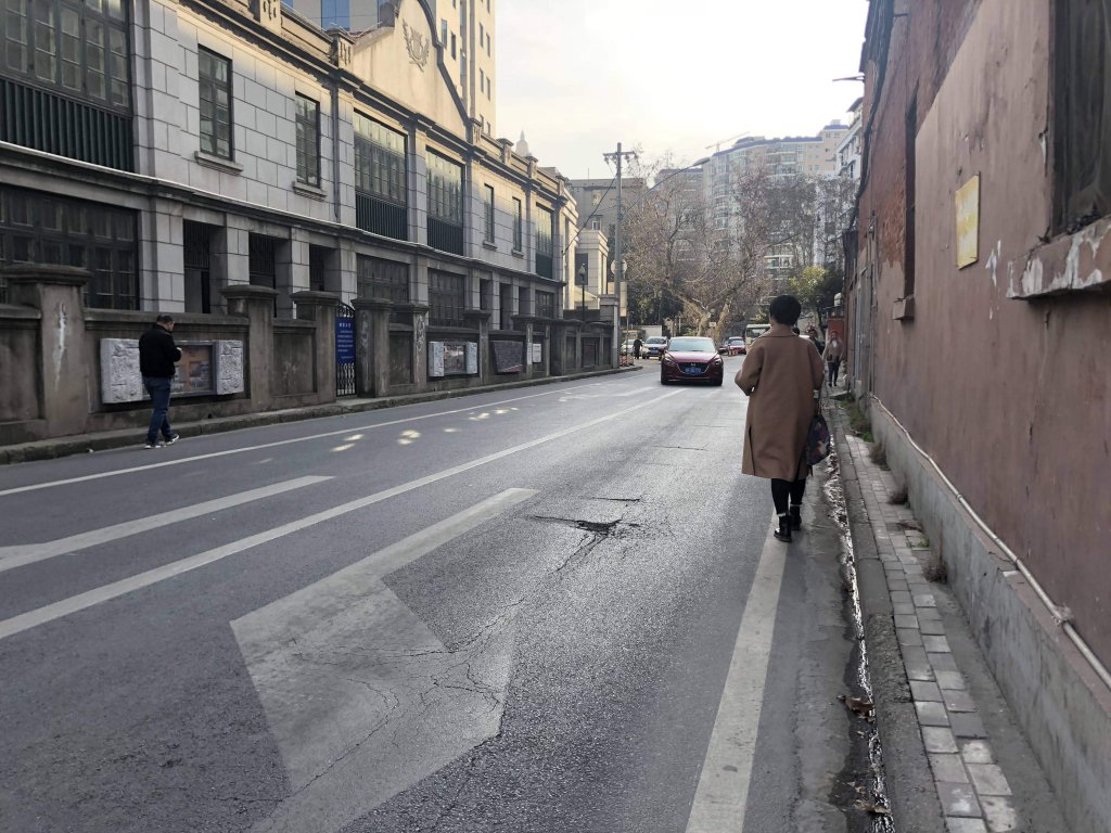
3. An uneven planning standard in sidewalk width, street obstacles, crossing design and maintenance ensures people feel de-prioritized and is causing unnecessary and severe safety hazards.
4. The district has an urgent need to distribute public life opportunities to the variety of existing public spaces. While some places are overcrowded with dancing and recreation, others remain empty.
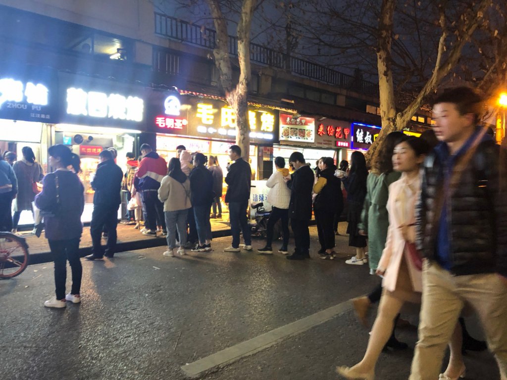
5. Hankou (and wider Wuhan city) has some dominant food streets. These are a big draw for people, but can become overcrowded and hinder the quality of public life if not managed well.
Recommendations & Key Moves Toward a Better Public Realm
The collective evidence gathered by the PSPL formed the basis for Gehl’s strategic recommendations. These comprised of twelve key moves across four themes: Transportation, Public Life, the Built Environment, and Climate Resilience. These themes provided a clear rationale and coherent structure to base future planning strategy and decisions and ultimately catalyse long-term change.
-
1. Prioritize pedestrians with a coherent network and pleasant walking environment.
2. Improve infrastructure for Bikes and E-bikes with lanes and parking.
3. Build your public transport system.
4. Reduce the impact of motorized vehicles.
-
1. Celebrate users with generous space offers.
2. Allow for use at different times of the day.
3. Create a balanced public space network.
-
1. Leverage the existing building network to meeting people at eye-level.
2. Create mixed-use human-scale neighbourhoods.
3. Develop maintenance and design standards.
-
1. Harness access to nature.
2. Plan for resilience.
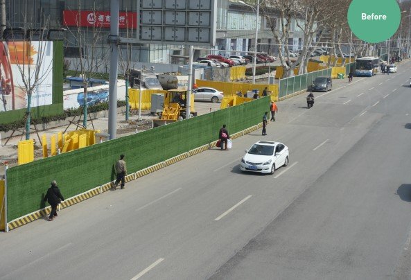
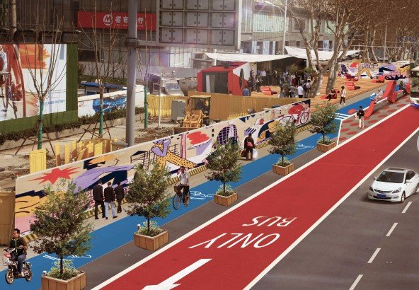
The 12 key moves are applicable to the whole Hankou District, but they must of course take into account the specific local context at play. To visualise this and provide inspiration for where to get started we developed a Public Space Plan. This showcases how and where the 12 key moves can be implemented across the most common place typologies such as arterial roads, corridors, city streets, local streets, food and beverage dominated streets, historical streets, alleyways, even construction sites.
Each typology features a local case study and location eligible for change, international best practice examples and before and after concept designs. Combining the recommendations with the Public Space Plan WPDI gains an inspirational catalogue for identifying opportunities to leverage current planning efforts, formulate future design briefs and plans, and ensure the district develops holistically.